District Profile

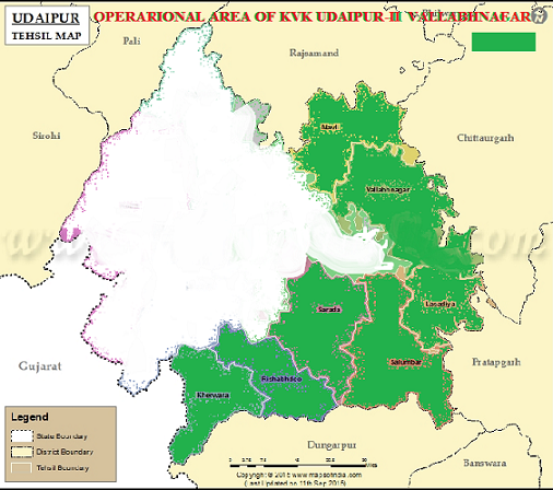
KVK, VBN is located in the Vallabhnagar block of Udaipur district in south-west Rajasthan and is in the midst of the Aravali mountain ranges. The geographical boundaries of the district extend from 23.45” to 24.8” North Latitudes and from 73.9” to 74.35” East Longitudes. Udaipur district has an estimated population of 26.33 million, 55% of which are tribal and out of the eleven blocks in the district, eight are composed largely of tribal communities. These communities depend primarily on agriculture and animal husbandry for their livelihoods, supplemented by income from seasonal employment in nearby towns, mining areas and commercially intensive agricultural areas in the neighbouring state. The geographical area of the district is 13419 sq. km. which is 3.65% of the state area. The terrain is predominantly hilly and undulating. The north-eastern part is plain where as south western part is mainly hilly. Nearly 42% of this area is unfit for agriculture. The region, which comes under Agro-climatic Zone IV-A (Sub-Humid South Plain and Aravali Hill Zone) is characterized by moderate rainfall and temperature variation between 0ºC - 25ºC in winters to 26ºC - 50ºC in summers.
Agriculture Profile
Out of the total geographical area, 4, 55,693 hectare is under cultivation, which constitutes 31.41% of total area. The irrigated area is around 98,889 hectare whereas un-irrigated area is 3,56,804 hectare. The main sources of irrigation are wells, tube-wells, ponds and tanks. Out of the total irrigated area, 80% is irrigated through wells. There are 69,887 wells, 107 tube-wells and 391 tanks. There are 3 irrigation divisions and 98 irrigation projects, which have created 68,443 hectares of irrigation potential. This network includes 6 tanks with the irrigation potential of 2,500 acres. Som-Kagadar, Jaisamand, Paduna, Ogna and Chhaperia are some of the projects, which are under construction.
Majority of this area is mono-cropped and area under double-cropping is only 1,09,448 hectare. Main agricultural crops are food grains (Maize, Jowar, Wheat, Barley) pulses (Tuar, Moong, Urad and Gram) and oil seeds (Mustard, Groundnut, Sesamum and Soybean). Area under food-grains is 2,66,130 hectare, whereas area under pulses is 46,180; oil seeds is 94,977; cotton is 139 and sugarcane is 2,714 hectares. The district is a leading producer of ginger in the state, which is cultivated in around 700 hectare in Jhadol.


